| (1)北を上にして見た京都地図 The Kyoto map as which north was carried out and regarded above |
(2)南を上にして見た京都地図 The Kyoto map as which south was carried out and regarded above |
 |
 |
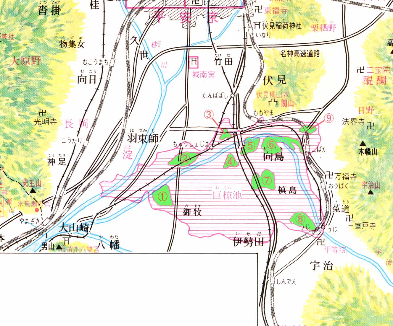
| 京都地図の見方について(About the view of the Kyoto map) |
| 南くんとの会話で京都の地図の見方があるのを記憶しています。 通常地図を見る場合(1)の様に北を上にして見ますが、実際には(2)のように、南を上に向けて地図をみます。 (Although you do and look at north above like (1) when usually seeing a map, in fact, like (2), you turn south upwards and see a map.) その理由は、京都市内へ出向こうと思った場合、国道1号線か国道24号線か国道170号線 の3本の道路が京都市内に向けて通っていますので、この国道の流通量を調整することで 京都市内への車の流入を制限することができるそうで、 具体的な方法は、名神高速道路へのジャンクション、インターチェンジ付近で 道路停滞を意図的につくりあげることで周辺の国道に停滞を連鎖的に起こします。 実際には道路を遮断することは出来ないので、下記のような目的があるようです。 (Since three roads, national highway the No.1 line, national highway the No.24 line, or national highway the No.170 line, pass towards the inside of a capital city when it is thought that the reason will go out into a capital city, inflow of the car into a capital city can be restricted by adjusting the amount of circulation of this national highway). (1)標的に道路停滞により時間的に遅らせる
(2)停滞が起こっていることが、道路情報掲示板にて解かると、 標的が意図的に他の道路を選ぶか、他の交通手段を選ぶことになります。 よって、標的の人物の動き(動態)を操作するということです。 (If it turns out that stagnation has happened, other roads will be chosen intentionally or other means of transportation will be chosen. I understand that therefore, a motion of a person is operated) 公安の例外採用者組織ネットワークの人間が、標的を操作することを目的としているようです。
(It aims at operating The person of target) |
| (1)北を上にして見た京都地図 The Kyoto map as which north was carried out and regarded above |
(2)南を上にして見た京都地図 The Kyoto map as which south was carried out and regarded above |
|
|
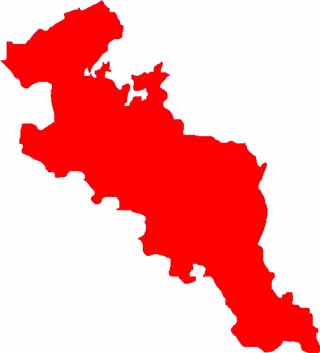
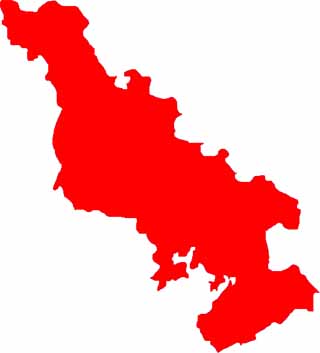
| 僕自身、独自の視点での考察 (Consideration with an original viewpoint of myself) 情報を元に、南くんの家庭環境など各種データを考慮に入れて考察した京都地図 (It considered, taking various data, such as Mr. Minami's home environment, into consideration.) 地図を上下逆さまにするのではなく、時間を逆さまにした京都地図 (The Kyoto map which did not make a map the vertical contrary but made time upside-down)
昔、京都府の宇治市近辺は水深が浅い小椋池(おぐらいけ)という大きな池がありました。 (赤い斜線部分が小椋池です) ( a long time ago, the Uji neighborhood in Kyoto had a big pond called the Ogura pond where depth of water is shallow) 現在の向島ニュータウンや宇治市の田園地帯がスッポリと池に収まります。 (The country zone of the present Mukaishima new town or Uji-city. It sinks in a pond.) 現在の京阪電鉄本線の中書島(ちゅうしょじま)、同鉄道(宇治線)宇治駅、近畿日本鉄道(京都線)の向島(むかいじま/むこうじま)、JRの宇治駅がこの小椋池に収まります。 中書島(ちゅうしょじま)、向島(むかいじま)、填島(まきしま)、御牧(みまき)は小椋池に浮かぶ小さな島みたいなものです。 (Cyusyo-jima, mukkai-jima, and maki- shima and mimaki are the small islands which appear on the Ogura pond) すなわち、徳川幕府の五人組の組織ネットワークは宇治市ではこれらの池ではない地域にあったと推理できます。 (That is, it can be guessed that the organization network of the five-man groups of the Tokugawa Political power was situated in the area which are not these ponds in Uji-City.) |
 |